Paricutin, the volcano in Michoacan
by Luis Dumois
On February 20th, 1943, after a couple of weeks of ominous earth tremors and strange underground sounds, the Paricutín volcano in Michoacán, erupted among prayers and rogations, fire displays and intense noise. The church bells of San Juan Parangaricutiro, five kilometers down the narrow valley, rang by themselves, dancing with the moving ground. Frightened people, not knowing what was going on, talked about the end of the world and punishment from Heaven.
The lava river flowed at a very slow pace, about three meters an hour, but. black volcanic ash covered roofs and roads, fields and flora, destroying everything. There were no crops that year, and soon there was hunger in the land.
The villages of San Juan Parangaricutiro and San Salvador Paricutín, the last just one kilometer from the rising volcano, were in danger, but nobody wanted to abandon land and home. President Lázaro Cárdenas himself went to San Salvador and tried to convince the people to leave, but, to no avail. The same happened in San Juan, where the President recruited the local priest to speak in favor of the immediate evacuation of the area. The people from Angahuan, a small town above the valley, witnessed their neighbors' fate with mixed feelings of anguish and relief.
In March, a new lava current aimed directly at San Salvador Paricutín forceing everybody to leave. They moved and founded the new town of Caltzontzin, on land assigned by the government, five kilometers south of Uruapan. Paricutín was completely swallowed by the volcano: and later, Caltzontzin by the urban development of Uruapan.
Meanwhile, the town of San Juan Parangaricutiro stood firm. By February, 1944, the speed of the lava flow was increasing, in spite of the prayers, masses and rogations. In April the river of melted rocks felled the wall of the cemetery. That was the sign for the people of San Juan to surrender their hopes. In the small nearby valley known as Los Conejos, Nuevo San Juan Parangaricutiro was born. "The men and women from San Juan left their dead, but took their memories with them."
Angahuan
Today everything is tranquil and quiet again. The best way to access the area is to go to Angahuan, the town that survived the catastrophe because it is located on top of the mountains that delimit the valley where the Paricutín stands. From the "Balcony of the Paricutín" you may enjoy a nice vista of the valley below, the Paricutín volcano itself, and the towers of the church of San Juan, still standing above the river of frozen lava.
Angahuan was founded by a Franciscan missionary, Fray Juan de San Miguel, in the XVI Century. As in other parts of Michoacán, the architectural school known as plateresco -a mix of Spanish, Arab and Mexican native ideas- flourished here. The facade of the church of the town is a good example of the intricate designs which characterize this style.
Paricutín
From Angahuan, a winding trail leads down to the valley. Either walking, or on horse back, to go down there is a wonderful adventure. No tall trees, just scant vegetation. Little movement along the way. You can hear yourself as you walk and look and think. This is a silent, somber, almost magical place. The soil is a deep black jewel, glittering in the sunlight. (These are the same metallic ashes that caused so much trouble and pain to the women and men of San Juan.)
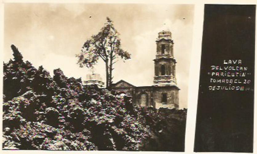
After a good walk through and over the solid trenches of frozen lava you will, finally, reach the ruins of the church of San Juan. It is quite an impressive view. An elegant tower rises above the lava, offering a sharp contrast against the rough, menacing waves of black from which they seem to emerge. The walls are still standing there, engulfed and surrounded by the black sea of volcanic rocks. Inside, a small niche protects an image of El Señor de los Milagros, The Lord of the Miracles, to whom the church was dedicated. Flowers and candles surround the icon, silent testimonies of a faith that is always present (in fact, the old town has never been forgotten. Every Holy Friday, the whole community of Nuevo San Juan marches in pilgrimage to their ancestor's village. They sleep in Patzingo, attend to Holy Mass in San Juan, and lunch over their houses.)
And then, onward to the mountain! A short walk, five kilometers to the north this time. Climb, climb, climb. From the top, there is a majestic view. The paths of lava are clearly outlined from the mouth of the monster volcano to the valley below. The rocks are warm to the touch in one of the small pits. Just a reminder. After a rest to gather up whichever strength is left in you, back to Angahuan again, half-lost in dreams of very cold beer and soft, comfortable seats.
How to get there
Angahuan is located in the central state of Michoacán. From Morelia, the state capital, take the autopista to Pátzcuaro and then to Uruapan. Then take Mex 37 to the north and Carapan. About 18 km from Uruapan there is a junction with the road that goes to Angahuan, another 20 km or so to the East. Regular bus service is available from Morelia to Uruapan and from Uruapan to Angahuan.
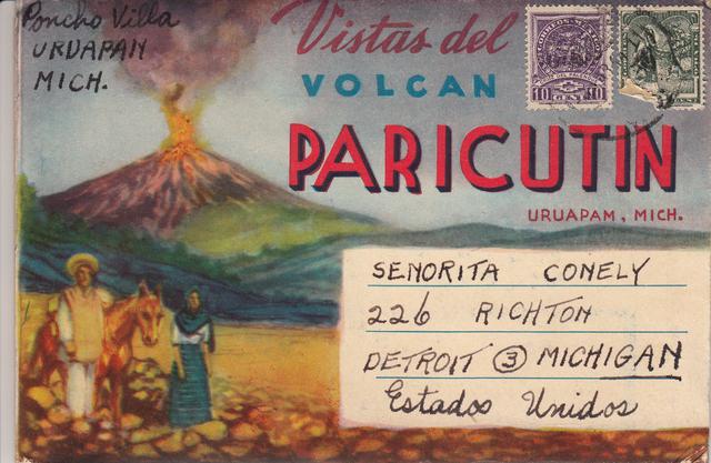
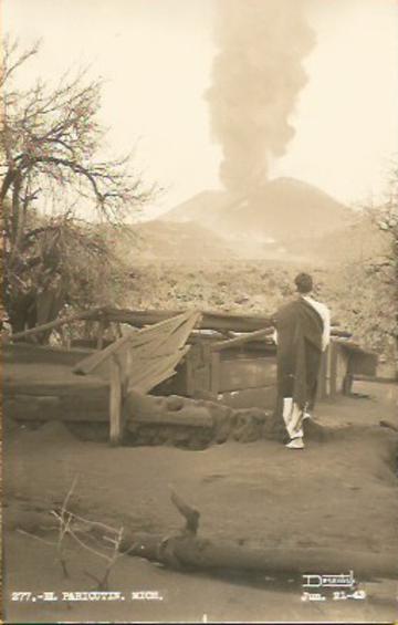
On February 20, 1943 the Paricutín volcano in Michoacán erupted near the village of San Juan Parangaricutiro
PARICUTIN
This is the earliest known postcard of the Paricutin volcano, taken on February 22, 1943.
The handwritten description of the postcard is:
"Volcan Parcutin Taken on the 2nd day since the birth of El Boreagui Uruapan Mich"
"Volcan Parcutin Tomada el 2do dia de su nacimiento El Boreagui Uruapan Mich"
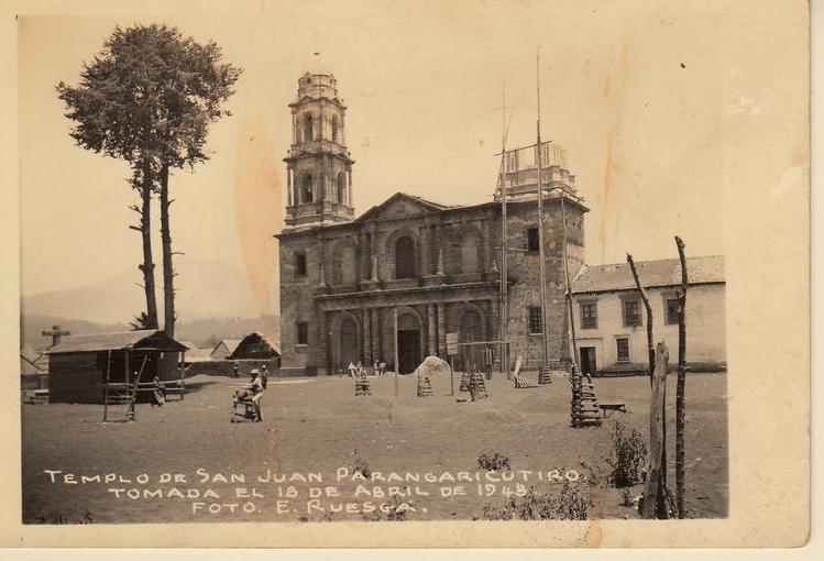
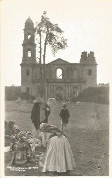
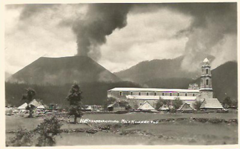
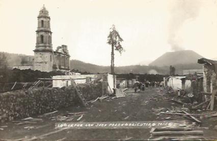
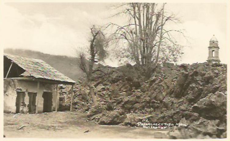
Photo postcard taken of San Juan Parangaricutiro three months after the start of the eruption, which was miles away and not expected to affect the church. Today, the entrance is through top left steeple, the only part of the church not covered by lava.
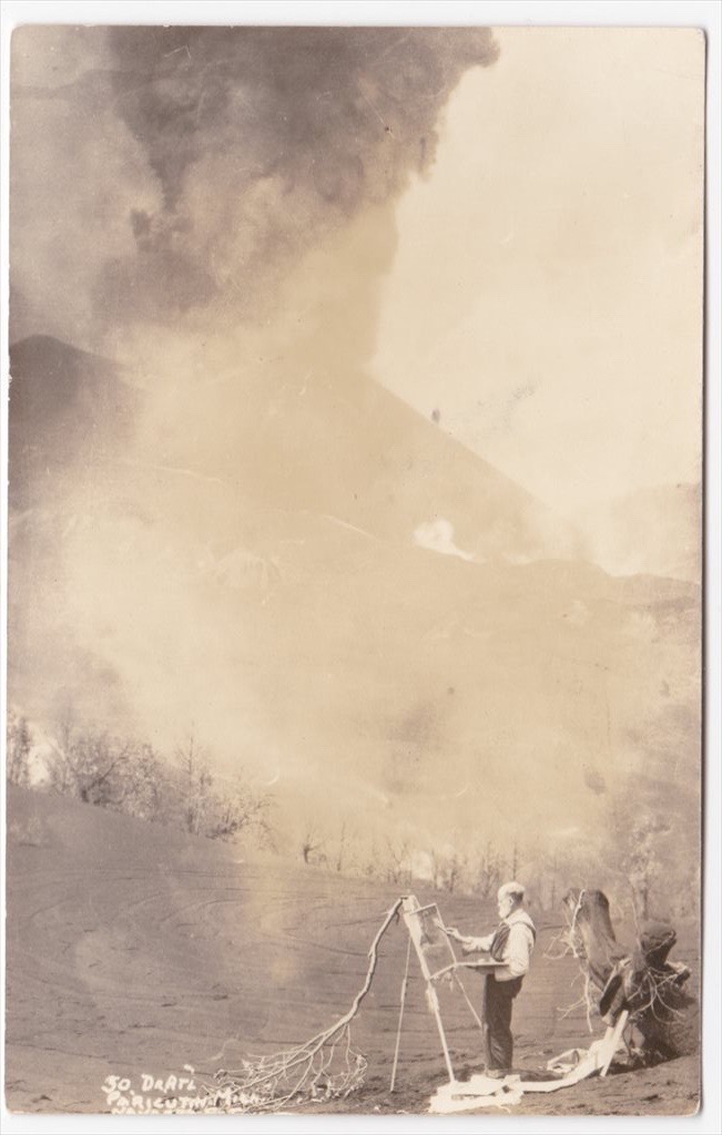
Dr. Atl is painting the erupting Paricutin Volcano. This is an extremely rare postcard. The Dr. was known to hire a photographer to take his picture and make a limited number of postcards to send to his friends.
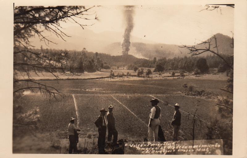
Photographers traveled with a photo-developing laboratory in the trunk of their car. They would take photos during the day, develop the film/print the postcards at night and spend the next day selling postcards to the tourists viewing the sights.

* * * * * *
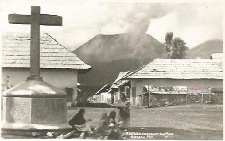
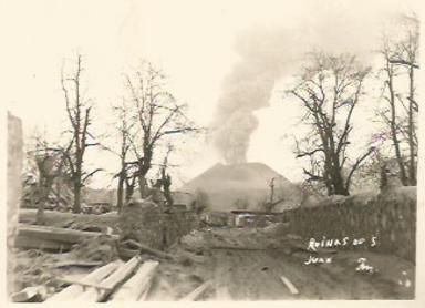
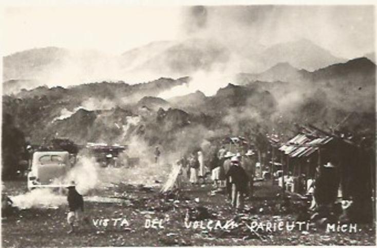
The Tarascan residents of Parangaricutiro patiently watch as the lava is flowing away from their village.
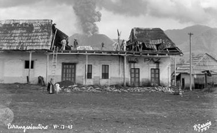
Lava started surrounding the church as residents packed their belongings to prepare departure of Parangaricutiro. The church is also being dismantled.
The neighboring village of Paricutin was in the direct path of the lava and quickly evacuated.
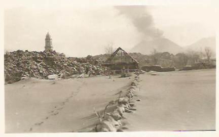
This postcard is the last known photo of Parangaricutiro. The entire village was covered, except for the top of the finished steeple.
The Tarascan villagers took everything they could.
Volcanic ash covered and smothered everything.
San Juan Parangaricutiro was evacuated and quickly abandoned.
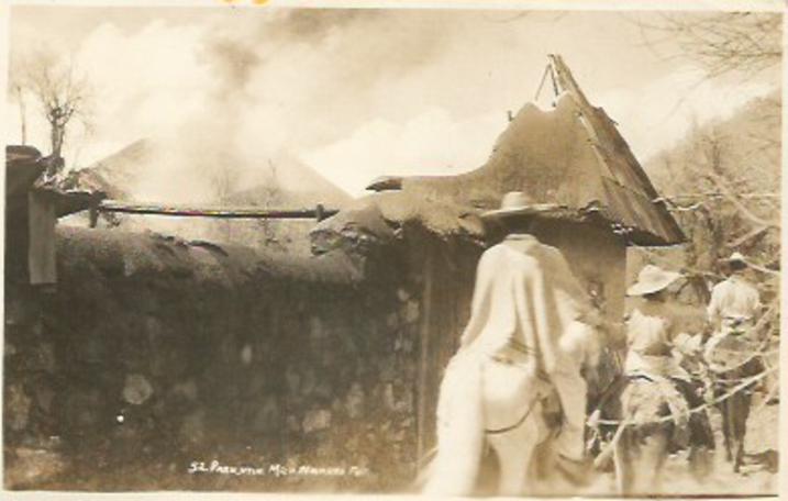
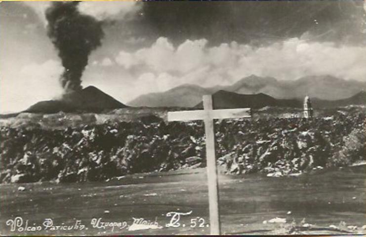
In July, the lava diverged and Paricutin Volcano
started covering San Juan Parangaricutiro.
Soon to be covered with lava, this is the last home in Parangaricutiro.
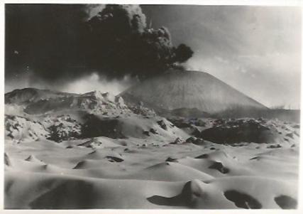
Within a few years, lava covered most of the valley.
Along with the massive flow of lava was the
arrival of enormous groups of tourists.
Formed in 1943, Paricutin Volcano was in
full eruption between 1946 and 1948.
It lasted for nearly a decade, ending in 1952.
Today, the volcano remains hot, with steam
occasionally released from the cone.
* * * * * *
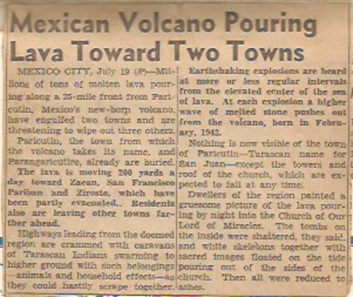
This article from 1944 was scotched-taped to a postcard.

This is a postcard of Paricutin from the 1950's,
which looks about the same today.
Mexico's other "recent" volcano was El Jorullo, which first erupted on 29 September 1759. Earthquakes occurred prior to this first day of eruption. Once the volcano started erupting, it continued for 15 years, eventually ending in 1774.
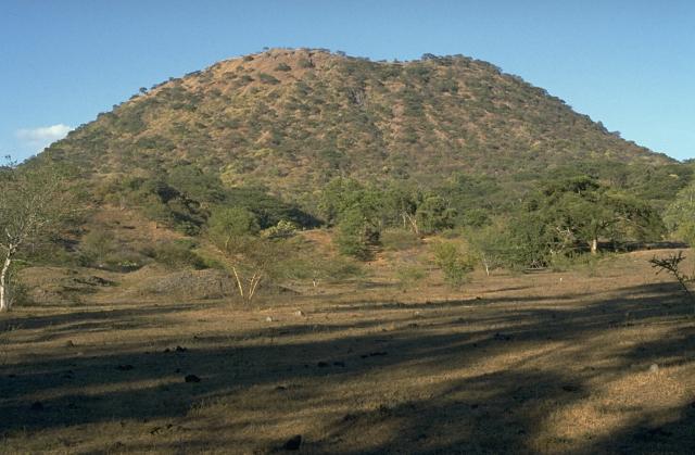
El Jorullo is a cinder cone volcano in Michoacán on the southwest slope of the central plateau, 33 miles southeast of Uruapan in an area known as the Michoacán-Guanajuato volcanic field. It is about 6 miles east-northeast of La Huacana. Its current elevation is 4,360 ft. El Jorullo has four smaller cinder cones which have grown from its flanks. It destroyed what had been a rich agricultural area.
El Jorullo is one of two known volcanoes to have developed in Mexico in recent history. The second, born about 183 years later, was named Parícutin after a nearby village that it eventually destroyed. Parícutin is about 50 miles northwest of El Jorullo.
Mexico's Other Volcano
El Jorullo first erupted on September 29, 1759
* * * * * * * * * * * * * * * * * * *
* * * * * * * * * * * * * * * * * * *